img_5040

img_5043

img_5045

img_5047

img_5048

img_5049

img_5052

img_5053

img_5055

img_5057

img_5058

img_5060

img_5063

img_5064

img_5068

img_5070

img_5072

img_5073

img_5074

img_5079

img_5080

img_5082

img_5083

img_5084

img_5085

img_5087

img_5091

img_5093

img_5094

img_5096

img_5097

img_5100

img_5101

img_5102

img_5103

img_5104

img_5105

img_5108

img_5113

img_5117

img_5118

img_5121

img_5122

img_5123

img_5124

img_5125

img_5126

img_5131

img_5139

img_5140

img_5141

img_5142

img_5143

img_5149

img_5152

img_5157

img_5159

img_5163

img_5164

img_5166

img_5167

img_5168

img_5171

img_5174

img_5176

img_5178

img_5179

img_5180

img_5181

img_5183

img_5184

img_5185

img_5187
This would make more sense if there were some bike lanes somewhere nearby ... but there are not.

img_5188
The bike isn't rideable with that sign on, so I guess it's just here as an advertisement?

img_5189

img_5190

img_5193

img_5197

img_5200

img_5201

img_5203

img_5204

img_5205

img_5210

img_5222

img_5228

img_5230

img_5236

img_5238

img_5242

img_5244

img_5245

img_5246

img_5248

img_5249

img_5250

img_5251

img_5252

img_5253
The locks are gone ...

img_5255

img_5259

img_5261

img_5262

img_5263

img_5264

img_5265

img_5266

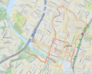
route
Total distance recorded was 17.36 miles, with 1155 feet of climbing (not always accurate). This includes my path before and after the ride. View interactive route here.